Waves, Data Buoys and Telemetry

Port-log data management and display
Port-Log is a quick and easy storage and publishing solution for environmental data acquired by Planet Ocean systems and sensors. It can be provided as pure cloud-based service, or as an in-house installed system. Port-Log provides the ability to store environmental monitoring data securely and publish it in near real time or historically on the web.
Planet Ocean
Planet Ocean is proud to represent some of the world’s leading, “gold standard” scientific instrument manufacturers and we bring you the very best from each of their specialist areas of expertise.

Radar wave sensor – UPS and telemetry system
A key requirement at very remote locations is data availability and independence of both the power supply and telemetry systems. The RADAC WaveGuide is a very robust package mechanically and electrically. Data are available via an integral Ethernet port.
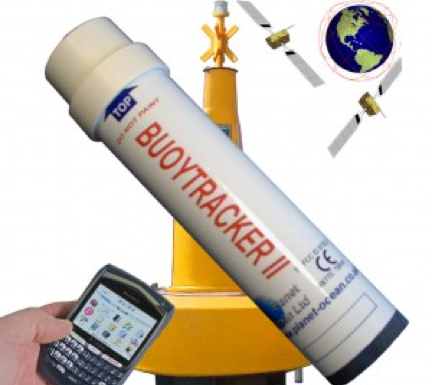
Buoytracker III globalstar-GPS surface mooring monitor
BUOYTRACKER III uses the GPS satellite positioning system, together with the GLOBALSTAR low earth orbit satellite data service and allows users to check the position of their buoy or other surface asset from a web page anywhere in the world; no special software is required.
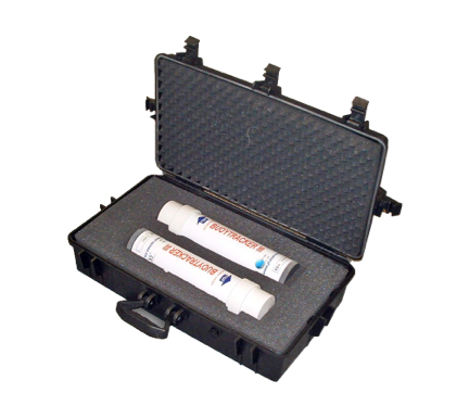
Buoytracker III – transit case
Water resistant case in Polypropylene. Holds two Buoytracker units. Built in pressure valve. External Depth – 180mm External Width- 430mm External Length – 720mm
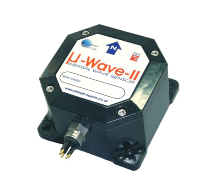
u-Wave-II inertial wave sensor
u-Wave-II Inertial Wave Height Sensor is a +5v to 30v ,low powered (150mW@12v) wave sensor that reports heading, significant wave height, dominant wave period, dominant wave direction, maximum wave height and maximum period via RS-232.
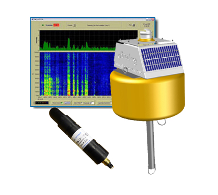
Acoustibuoy – passive acoustic monitoring (PAM) buoy
Acoustibuoy, is a Passive Acoustic Monitoring Buoy (PAM) designed to utilise the special features of ic-Listen, Smart Hydrophones to monitor, record and display acoustic data in realtime. Used for ship noise measurements, marine mammal monitoring, underwater noise studies or general acoustic studies.
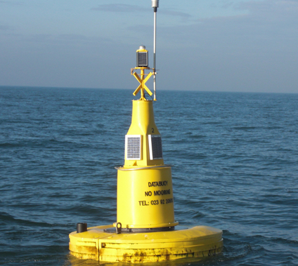
MetBuoy – meteorologica monitoring buoy
MetBuoy is designed to monitor, record and display wind speed & direction togehter with meteorological data in our full range of data buoy platforms or as a land, jetty or building based installation. Powered by TRISKEL Marine, data telemetry modules.

Turbibuoy – dredge monitoring buoy
Turbibuoy is designed to monitor, record and display turbidity data in support of water quality monitoring or dredge monitoring operations. One or two, Analite or YSI sensors may be deployed. Turbibuoy allows users to enter their own calibration curve to convert NTU to mg/L.
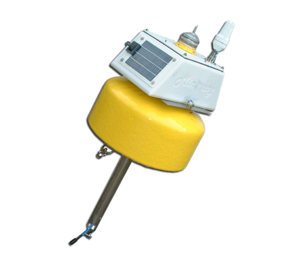
Minibuoy OEM data buoy
The smallest in our data buoy range, MINIBUOY is designed for sheltered water operations, and can carry 5W or 10W solar panels. Minibuoy is tough, lightweight and easily deployed and recovered. When fitted with our DBT-3 telemetry, operation is completely autonomous, with no user controls, or set up required at the buoy.

MB-07
The MB-07 is the latest rotationally moulded mooring marker buoy. This buoy is primarily designed for use in inshore coastal applications. Shown as a marker buoy it is normally supplied in yellow although green and red lateral marks are available.
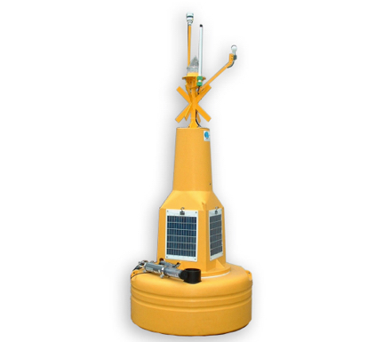
DB-125 OEM data buoy
The DB-125, 1.25m dia data buoy system is designed for sheltered water operations to 50m depth where instrumentation is required to be deployed near the surface and can be used as a permanent or temporary platform.
DB-XXX OEM data buoys animation
This animation shows how the DB range of data buoys offer a huge range of configurations and features to suit most applications.
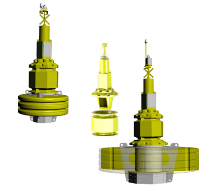
DB-XXX OEM data buoys
The DB-XXX range of buoys covers the 1.8, to 3.6m diameter and are designed for open water applications where instrumentation is required to be deployed near the surface and can be used as a permanent or temporary platform.
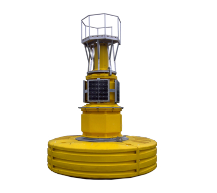
DB-360 OEM data buoy
The DB-360 is the largest in the current range of Data Buoy Hulls available from planet Ocean. The 3.6m diameter platform houses batteries in the hull in a water tight compartment, lowering the CofG and providing a very stable platform for open ocean use.
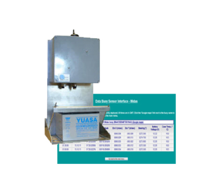
DBT-4 telemetry module
Used in our DB & Minibuoy range of data buoy hullsThe DBT-4 telemetry systems provide the link between sensor and desk for simple implementation of remote, pseudo-real-time telemetry on data buoys or other remote locations. Systems are available using radio, cellular and satellite telemetry.
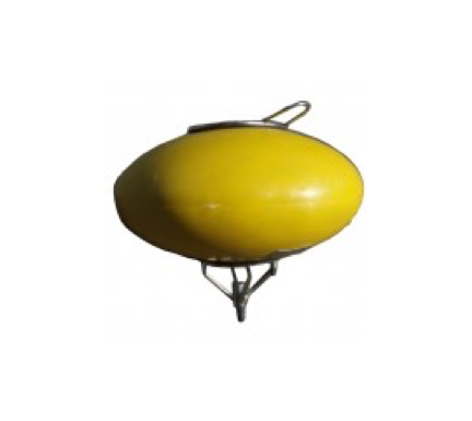
Ellipsoid low drag subsurface buoys
Ellipsoid shaped subsurface buoy that provides a lower drag coefficient than traditional shaped spherical buoys.
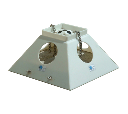
TRSF-1 trawl resistant seabed frame
The TRSF-1 frame was designed to overcome the problems associated with corrosion of fabricated steel frames and to offer a level of trawl resistance.
SeaView
SeaView Systems, Inc was founded on experience in the world of maritime electronics and Remotely Operated Vehicles. Their SVS-630 Wave sensor and logger is based upon their knowledge of Inertial Navigation Systems (INS) and the advancement of over 50 ROV Projects resulting in a portfolio of OEM components for ROV systems including video drivers, light controllers and multiplexors.

SVS-603 OEM Inertial Wave Sensor
The SVS-603 Wave Height Sensor is a highly accurate MEMS-based sensor that reports heading, wave height, wave period and wave direction via RS-232 or logs to its on-board data logger.

u-Wave-II intertial wave sensor
u-Wave-II Inertial Wave Height Sensor is a +5v to 30v ,low powered (150mW@12v) wave sensor that reports heading, significant wave height, dominant wave period, dominant wave direction, maximum wave height and maximum period via RS-232.
Radac
Radac are a Dutch company, based in Delft. Since 1996, they have developed and manufactured the WaveGuide. This high quality radar system monitors waves, tide and water levels. Ii is compact, robust and easy to install. Systems are available with intrinsically safe certification, with directional wave capability, and also for installation on ships or floating platforms.
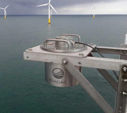
Radac waveguide radar wave sensor
The WaveGuide Height & Tide accurately measures wave height and tide. The new WaveGuide is the latest and most technically advanced radar from Radac. This accurate wave monitoring system is an easy to use, reliable and robust device to measure freeboard, wave height and wave period.
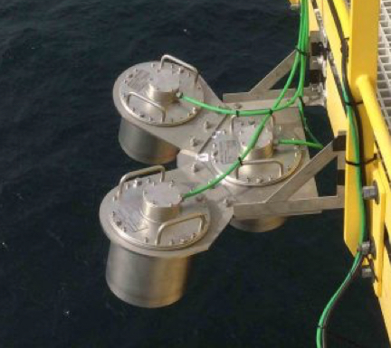
Radac waveguide, directional radar wave sensor
With an array of three radars the elevations of the sea surface is measured at three positions. Knowing the slopes and the phase relations, the directional spectrum can be accurately calculated. Radac is the only company that brings this technology to the market.
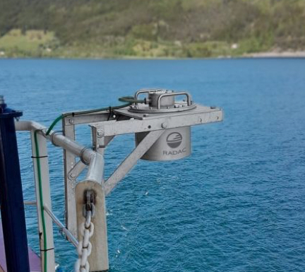
Radac on board shipborne radar wave sensor
The Onboard wave radar, mostly installed on the bow of the ship, measures the distance to the water surface. The distances measured have to be compensated for the vertical motions of the radar itself. Hence, a motion sensor is incorporated into the radar unit.

The team at Obscape takes care to ensure that each of their products is expertly crafted and share the same core characteristics.

WaveBuoy Solar & WaveBuoy Solar
Wave measurements are an indispensable part of any MetOcean or Limnology project. The Obscape Wave Buoy is based on recent advances in solar power, sensor and data technology, ensuring a rugged, light-weight, reliable and affordable wave buoy. Available as a solar powered buoy with battery backup or fully battery powered.
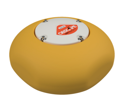
OBS-BUOY400 Wave Buoy
The Obscape OBS-Buoy400 is the most affordable metocean buoy that collects and transmits real-time full wave and sea surface temperature data. Superior elliptical design for the most accurate wave tracking and temperature measurements in its class.
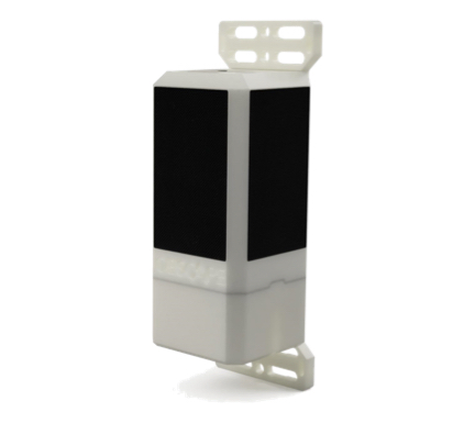
Wave Gauge
Non-contact radars offer the highest resolution of sea wave measurements in real-time. Obscape’s radar Wave Gauge offers a low-cost and user-friendly way to obtain accurate nearshore wave observations.
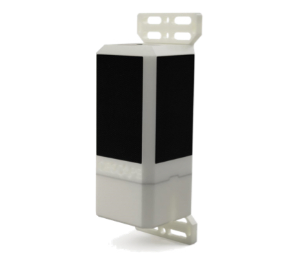
Wave Module
Highly accurate real-time wave measurement system that reports the non-directional wave spectrum including wave height, wave period and more.
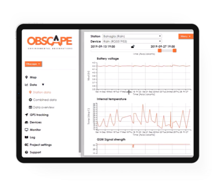
Data Portal
Real-time data from all your Obscape sensors will be collected into the Obscape Data Portal, your gateway to the field. The convenient map-based interface allows for integral management of your data, devices and operations. Click below for demonstration.
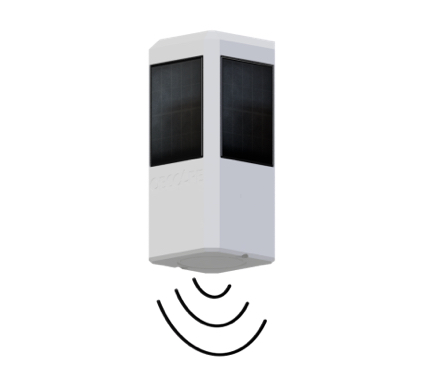
Water Level Gauge
Obscape’s Level Gauge delivers real-time water level measurements. It records the water level using a highly accurate radar sensor. Since the instrument is mounted above the water surface, deploying it in the field is easy.
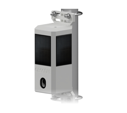
Time-Lapse Camera
Obscape’s Time-Lapse Camera is a robust, fully wireless solution that delivers time-lapse images to your desktop in real-time. It allows you to have a look at your area of interest at any time of the day, wherever you are.

HQ Time-Lapse Camera
Obscape’s HQ Time-Lapse Camera is ideally suited for long-term visual monitoring of gradually evolving processes, such as beach and river morphology, littering of surface waters or construction works.
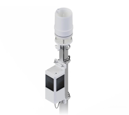
Weather Station
Obscape’s Weather Station supplies you with real-time weather data. and was designed for continuous deployment in harsh climates, which means there are no moving parts to fail.
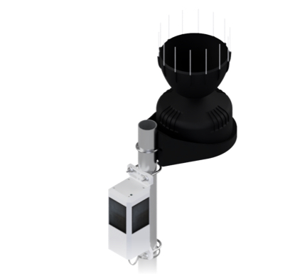
Rain Gauge
Obscape’s Rain Gauge delivers real-time rainfall measurements. Its industry-standard rain collector is connected to Obscape’s Power and Telemetry Module to create a completely wireless real-time rain gauge.
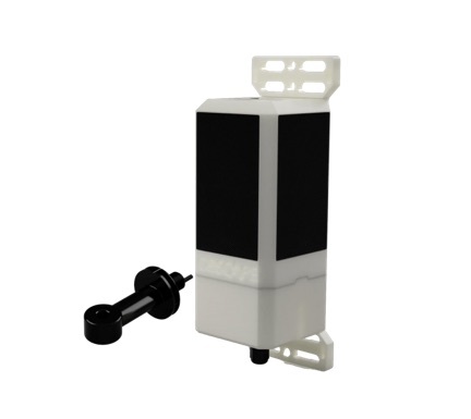
Conductivity Temperature Station
Obscape’s CT Station is the ideal all-in-one solution for real-time conductivity,
temperature and salinity measurements. It combines the robust Obscape Power & Telemetry Module with a low-maintenance toroidal CT probe.
Together they form a CT Station that is unchallenged in its ease of use.
Whether you are monitoring aquatic habitats, estuarine hydrodynamics
or salt intrusion, the Obscape CT Station will suit your needs.
Also available with multi-paramer sonde for total water quality applications
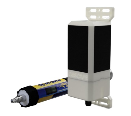
Water Quality Station
Obscape’s PTM core is integrated with the capacity to mount a 3rd party multiparameter Water Quality sonde ( In-Situ AquaTROLL or YSI EXO), which can accommodate up to, 4 different types of water quality measuring sensors. Pricing does not include Water Quality sensor, 3rd party cabling and if additional power supply is required.
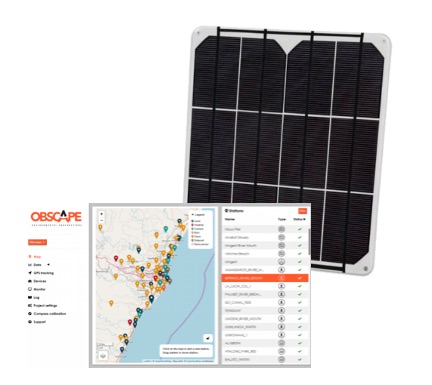
External Solar Panel and Data Portal
The value of real-time observations strongly depends on the ability to view and analyse them in real-time. Therefore, the Obscape External Solar Panel enables the PTM to transmit data in challenging sunlight conditions to the Obscape Data Portal.
Global Sim
Obscape aims to make real-time environmental monitoring as accessible and user- friendly as possible. Our Global SIM solution is the missing link to giving you a plug & play experience with your Obscape devices.
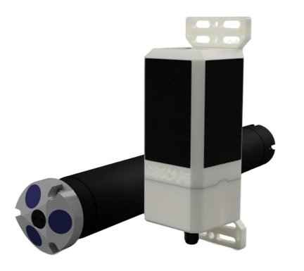
ADCP Station
Obscape’s PTM core is integrated with the capacity to mount a 3rd party Aquadopp Profiler from NORTEK which is suitable for mounting to surface buoys. Pricing does not include Aquadopp sensor, 3rd party cabling and if additional power supply is required.
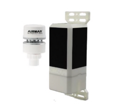
Multisensor Ultrasonic Offshore Weather Monitoring
Weather impacts every aspect of operations on offshore platforms, ships, and in ports. Rapid changes in weather and sea conditions make monitoring of both meteorological and oceanographic parameters a critical part of ensuring safety, while also maintaining operational efficiency.
