
Discover the dotOcean range
Automated sediment density measurement, and Worldwide control of autonomous surface vessels in the global ocean
dotOcean provides sophisticated, automated tools for sediment density measurement, along with control systems for autonomous navigation of vessels and advanced situational awareness software for the maritime and defense industry.
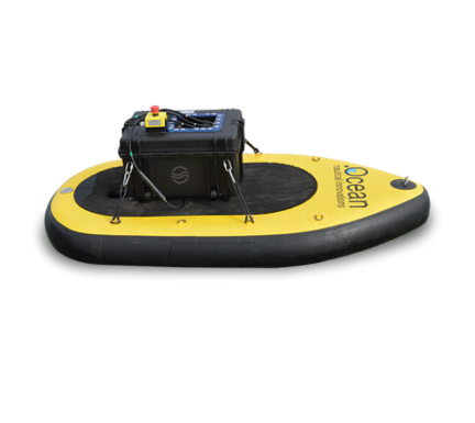
The Autonomous Survey Platform (ASP) Calypso is an inflatable, remote controlled drone that can carry a wide range of sensors for hydrographic and environmental surveys. The ASP is easy to transport and can be installed and operated by one person. Only a Peli Case and a backpack are required for transport.
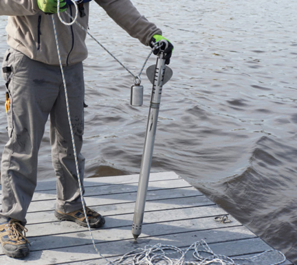
Graviprobe free fall penetrometer
The GraviProbe is a free fall impact instrument, analyzing the underwater sediment layers during intrusion. Under its own weight it accelerates and penetrates fluid and consolidated mud layers. The geotechnical and density conditions of the soil layers are determining the probe’s dynamical behavior.
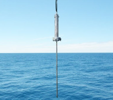
Deep Sea free fall graviprobe penetrometer
Developed to capture high quality geotechnical profiles of fluid and consolidated mud layers at maximum depths of 5500 meter. The Deep Sea GraviProbe is a geotechnical profiling system for deep sea waters.

DensX sediment density profiler
The DensX is a high accurate in situ mud density measurement system. It measures mud densities between 1.0 T/m³ and 1.5 T/m³ with an accuracy of 0.25 %. The technology is based on X-ray and is a direct measurement method. With a sampling speed of 10 Hz the system supports fast profiling.
iCone
dotOcean is currently developing an intelligent sounding pole (NL: “intelligente peilstok”). With this manual mud or sediment profiler it is possible to analyze underwater soil layers in small waterways and rivers by manually pushing the instrument in the soil.
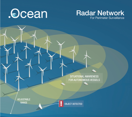
Radar network for perimeter surveillance
Wind farm and offshore installations are critical and valuable assets at sea. Operators and contractors want to have a continues view on all ship movements in the area of the asset. The main reason is safety and operational management. To protect subsea cables, foundations, piles and installations, access to the park for unauthorized vessels is prohibited or limited.